
Maps of Northern Ireland

These maps, based on a census carried out three years after the Good Friday Agreement, show how in most parts of Northern Ireland, Catholics and Protestants mainly live in different areas.
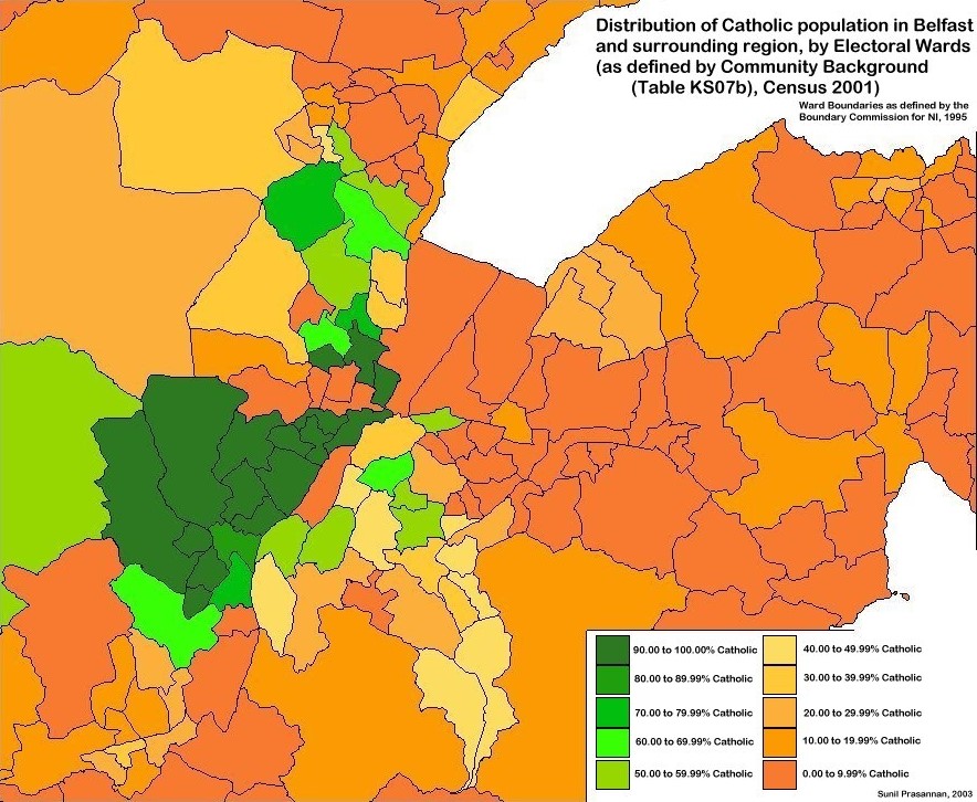
The first map shows the whole of the province, the second is an enlargement of the area around Belfast, the capital and largest city. The darker the colour – green for Catholics and orange or brown for Protestants – the more one or other community dominates an area. There are indeed some lighter shades that indicate more mixed areas. In general, though, it is striking that Protestants are concentrated on the eastern side of Northern Ireland. Catholics live largely in the west and south, apart from a small pocket in the far north-east. Within Belfast, there is a similar separation, with Catholics living mainly in the west of the city and Protestants in the east.
Consider the effects of people living largely separate lives in this way. When Catholics and Protestants rarely interact as neighbors or friends, understanding and mutual respect become more challenging. This divide has only deepened over the years, as minority groups in certain areas have often felt unwelcome or even unsafe, leading them to relocate elsewhere.
Do you think this issue is unique to Northern Ireland, or have you observed similar divisions elsewhere, perhaps even in your own community?